
Universitas Negeri Semarang (UNNES), as a Conservation University, contributes to aquatic ecosystem protection through environmental research, field-based learning, community engagement, and conservation initiatives. Its published work addresses river systems around Semarang, including the Kaligarang, Kreo, Tapak, and Babon rivers, as well as coastal and campus water environments. These activities support the objectives of Sustainable Development Goal (SDG) 14 by promoting aquatic biodiversity awareness, environmental assessment, and responsible ecosystem management.
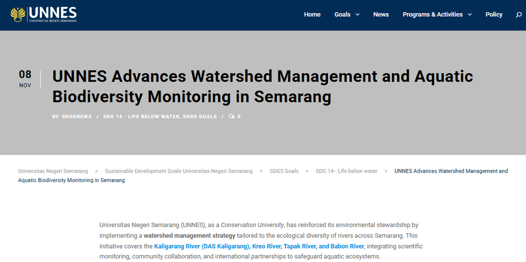
UNNES’s institutional overview, UNNES Advances Watershed Management and Aquatic Biodiversity Monitoring in Semarang, describes water-quality assessment, aquatic biodiversity observations, riparian vegetation, and collaboration with environmental partners. The article was published on 8 November 2024 and provides a starting point for understanding the university’s approach. However, the available evidence does not establish that a formally approved, species-specific watershed management plan covering all four rivers was implemented in 2025.
1. Aquatic Biodiversity Research and River Ecosystem Assessment
Understanding the ecological characteristics of a watershed requires information about water conditions, aquatic organisms, riparian vegetation, and the pressures affecting each river. Water-quality parameters such as temperature, pH, turbidity, dissolved oxygen (DO), chemical oxygen demand (COD), nitrate, and phosphate can help researchers characterize environmental conditions. Biological observations can complement these measurements by documenting the organisms and habitats present at particular sampling locations.
UNNES’s published watershed article identifies the Kaligarang, Kreo, Tapak, and Babon rivers as relevant areas for environmental monitoring. It also refers to native freshwater fish such as baung, nilem, and wader as species of interest in aquatic biodiversity monitoring.
However, the available article does not provide a complete species inventory for each river, numerical fish population data, or a site-by-site comparison of water quality and riparian vegetation. These details are necessary to establish ecological differences among the watersheds and determine which conservation measures are appropriate for each location.
Research on riparian vegetation provides additional scientific context. A study published in the UNNES journal Life Science examined plant diversity along the Kaligarang River using observations at three locations: Tinjomoyo, Tugu Soeharto, and the area behind the Tirto Moedal water utility. Sampling was conducted from May 2023 to May 2024.
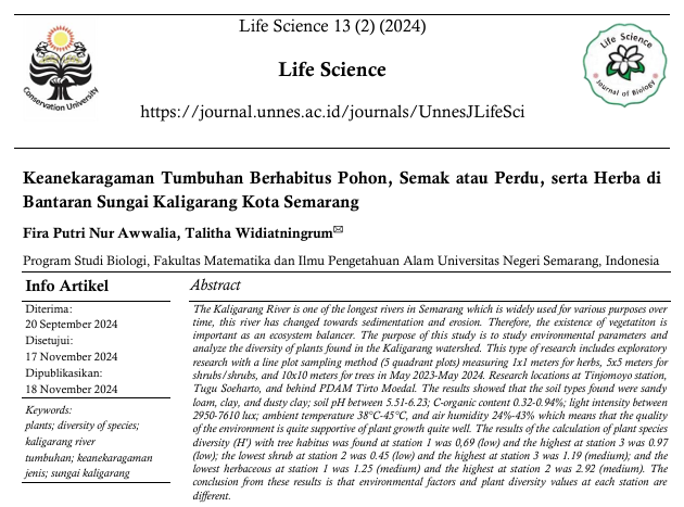
The study, Keanekaragaman Tumbuhan Berhabitus Pohon, Semak atau Perdu, serta Herba di Bantaran Sungai Kaligarang Kota Semarang, reported differences in plant diversity among sampling locations and vegetation growth forms. This provides a scientific basis for recognizing that riparian vegetation characteristics vary across sites. However, the study concerns vegetation along the Kaligarang River and should not be treated as a complete biodiversity inventory for all four watersheds or as evidence of a 2025 restoration outcome.
2. Field-Based Monitoring in Coastal Ecosystems in 2025
On 6 May 2025, students from the Environmental Science Study Program at UNNES conducted a field excursion in the Tapak mangrove area and at Tirang Beach, Semarang, as part of the Coastal and Marine Management course.
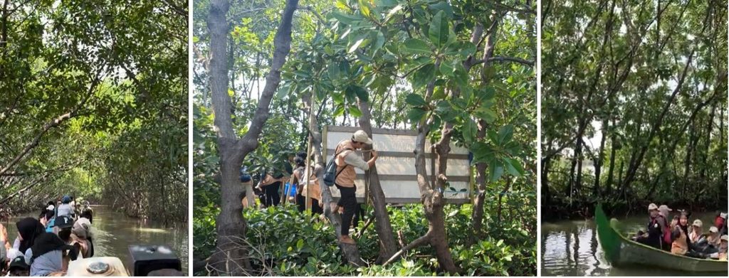
The activity is documented in the official UNNES report. The fieldwork involved collecting information on abiotic conditions, including meteorological conditions, salinity, and water quality; biotic components, including fauna diversity and mangrove biophysical characteristics; and socio-cultural aspects, including community use of coastal resources and local ecological knowledge.
This activity provides documented evidence of field-based environmental assessment during 2025. It also illustrates how student learning can contribute to the collection of ecological information relevant to coastal ecosystem management.
Nevertheless, the published report does not provide a complete dataset of measurements, a multi-period trend analysis, or evidence that the results were incorporated into a formally approved watershed management plan. The activity should therefore be described as field-based ecological assessment rather than proof of a comprehensive, long-term monitoring program across the Kaligarang, Kreo, Tapak, and Babon watersheds.
3. Community Collaboration in the Garang Watershed
Community participation is an important component of integrated watershed management because residents interact with rivers and can contribute local knowledge about environmental changes and resource use.
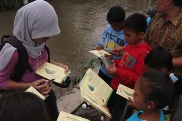
The BINTARI Foundation has documented community-based environmental education in the upper Garang watershed through its initiative, Aku, Sahabat DAS Garang, published on 17 November 2022. The activity involved 30 children from 15 elementary schools in the Lerep area and used river-based learning to introduce ecosystem components, activities that can damage river environments, and possible actions to improve them.
BINTARI describes the activity as a prototype action developed through the Garang Watershed Leadership Program, which brought together stakeholders including UNNES, Diponegoro University, local government bodies, the regional water utility, and other organizations. The initiative sought to strengthen shared understanding and encourage coordinated watershed management.
This source demonstrates a documented history of collaboration and community-based river education. However, because the activity took place in 2022, it cannot independently establish that the same program or partnership arrangement was implemented in 2025. Any claim of continuing collaboration should be supported by more recent activity reports, meeting records, or agreements.
For future watershed management, community participation could be documented through river cleanups, riparian vegetation maintenance, local biodiversity observations, environmental education, and community reporting of pollution incidents. Such activities would need to be linked to specific locations, responsible organizations, and documented follow-up actions.
4. Aquatic Habitat Management at the UNNES Campus Retention Basin
UNNES also documented a habitat management initiative at its campus retention basin in December 2025. On 30 December 2025, the university’s Conservation Subdirectorate collaborated with the Semarang City Fisheries Service to release 5,000 fish juveniles into the campus retention basin.
The activity was reported in Rehabilitasi Ekosistem Lingkungan, UNNES Tebar Lima Ribu Benih Ikan.
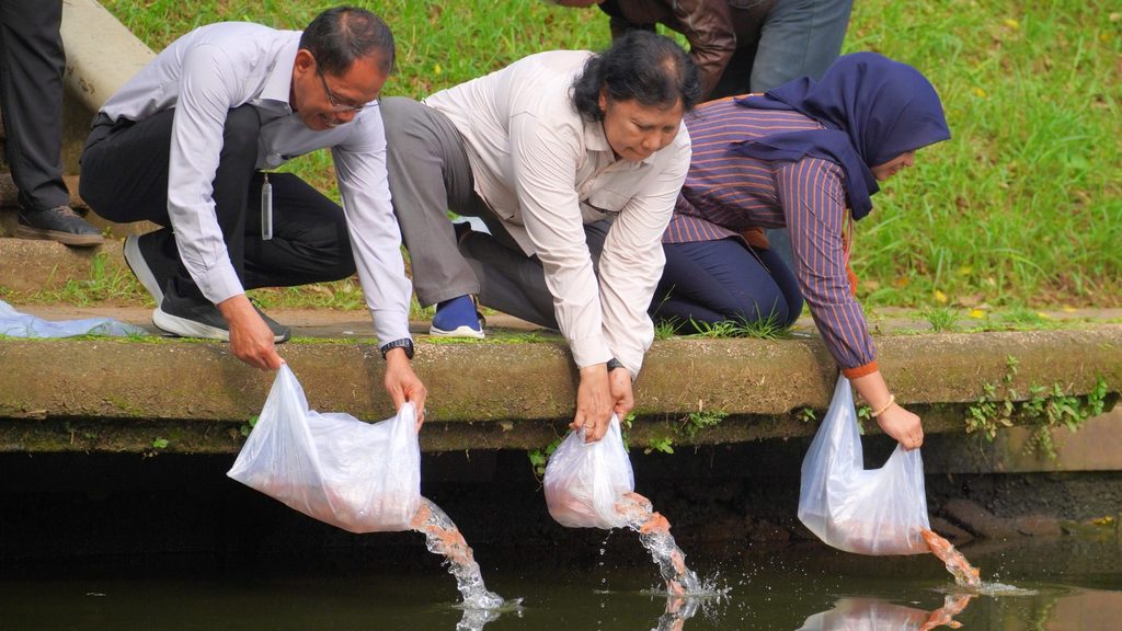
The initiative aimed to support the retention basin’s function as an aquatic habitat, an environmental education resource, and part of the university’s conservation activities. The collaboration also demonstrates participation by a local government fisheries institution in campus-based aquatic resource management.
The documented output was the release of 5,000 fish juveniles. However, the report does not establish post-release survival rates, changes in aquatic biodiversity, or measurable improvements in water quality. The activity should therefore be understood as a documented habitat management intervention rather than proof of a quantified ecological recovery.
It is also important to distinguish campus retention basin management from watershed management. The fish release is relevant to UNNES’s broader aquatic conservation activities, but it does not demonstrate the implementation of species-specific management measures in the Kaligarang, Kreo, Tapak, or Babon rivers.
5. Toward Ecologically Specific Watershed Management
The available evidence demonstrates several complementary contributions by UNNES and its partners: riparian vegetation research along the Kaligarang River, student field assessment in the Tapak mangrove area and at Tirang Beach in 2025, historical community-based river education through BINTARI, and aquatic habitat management at the campus retention basin in December 2025.
To establish a formal watershed management strategy tailored to ecological characteristics and aquatic species diversity, further documentation is needed. This should include an officially approved management plan, biodiversity inventories for each watershed, verified fish observations, riparian vegetation assessments, water-quality monitoring records, and defined responsibilities for implementation.
A complete management framework would also identify the conservation measures appropriate to each location, the institutions responsible for implementation, the monitoring schedule, indicators of success, and the process for reviewing results. These elements would allow environmental findings to inform practical management decisions and subsequent adjustments.
For example, a management plan might identify priority locations for riparian vegetation protection, specify sites requiring further water-quality assessment, and establish procedures for recording changes in aquatic biodiversity. Such measures should be presented as implemented actions only when supported by approved plans and activity records.
6. Contribution to SDG 14
UNNES’s research, field-based learning, community education, and aquatic habitat initiatives provide evidence of institutional engagement in aquatic ecosystem conservation. The documented 2025 field excursion and fish release offer dated examples of environmental assessment and habitat management, while the Kaligarang vegetation study and BINTARI’s watershed education initiative provide additional scientific and community context.
Nevertheless, the available sources do not establish a fully implemented, formally approved watershed management strategy based on species diversity across all four rivers. Nor do they provide a consolidated dataset showing changes in water quality, fish populations, or riparian vegetation during 2025.
Strengthening the connection between research, formal management plans, community collaboration, and measurable ecological outcomes would enable UNNES to demonstrate more clearly how its activities support SDG 14. Transparent reporting of locations, partner responsibilities, monitoring methods, and follow-up results will be essential for assessing progress toward long-term aquatic ecosystem protection.